Sunday, December 15, 2013

Route 100 Initiatives & Evaluation

As our online user survey of Route 100 just closed last night and I am beginning to analyze the results...I thought it wise to reflect on the history of the project and highlight were some of our survey questions came from.


The CIVITAS Initiative

The Route 100 project was planned as a CIVITAS Initiative project. The CIVITAS Initiative is an organization co-financed by the European Union that engages local sustainable mobility projects in cities throughout Europe. The organization’s aim is to support the implementation and evaluation of innovative strategies for sustainable transportation. Each of these projects is referred to as a ‘measure’ and CIVITAS has thus far tested over 800 different sustainability ‘measures’ in over 60 demonstration cities. The City of Aalborg joined the CIVITAS Archimedes project from 2008 to 2012. Six other demonstration cities were involved with the Archimedes project and each focused on creating innovate transportation systems in mid-sized cities that are safe, sustainable, and efficient. In Aalborg, sixteen 'measures' were tested and one of the 'measures' was the implementation of Route 100. The Route 100 project has the title “Cycling Motorway” and is CIVITAS measure number 51.
This project was funded

  1. Free flow conditions for cyclists:  The route should minimize unnecessary stops and exhibits clear priority for bicycle riders.
  2. Traffic Safety:  Bicyclist using the route should be safe.
  3. Visibility and Service:  Extra service should be provided along the route to increase   the allure of bicycle commuting.


Goals for Route 100

This project was planned with three primary goals in mind. These goals were developed in collaboration between the CIVITAS Initiative and Aalborg Kommune, reflective of the city-wide goals for the future development of bicycle facilities.

In order to achieve these goals, the city created a “tool box” of innovative initiatives to make bicycle commuting to the campus more attractive. The initiatives developed are reflective of the three goals and aim to improve the journey between the City Centre and the Aalborg University campus by making the journey more efficient, safer, and by implementing additional services to riders along the route.

A total of seven initiatives were planned and implemented along the route. To augment the success of the suite of innovative initiatives, the asphalt was repaved on portions of Hadsundvej and new bicycle lanes were stripped along Bønnenesgade and Riishøjvej. Three separate sources of funding were used in order to implement the improvements… Half of the funding was provided from the EU, via the CIVITAS Initiative. Another thirty-three percent came from Cykelpuljen ("the bicycle pool"), a national funding source for bicycle projects throughout Denmark. The remainder was paid for by Aalborg Municipality tax dollars. Construction on the Route 100 initiatives began in August 2010 and each was completed by Spring 2011.

As the two outside funding sources require post-implementaiton evaluation, the Municipality implemented a survey shortly after the construction of the last initiative in 2011. A total of 300 Route 100 users responded to the survey and an evaluation was done of the facility, based on the results of the survey. Respondents were asked if they were familiar with each individual initiative, as well as being asked how important they feel each initiative is on a scale of 1 to 10.


Route 100 Initiatives and Evaluation

Although different than the purpose of the users survey implemented for my Get Your Kicks on Route 100 research project, my research partner and myself repeated these basic questions in our recent survey. The purpose for doing so was to investigate whether opinions have changed, for better or worse, since the initial survey was given 2011. Our online user survey closed on December 13, 2013 and we received responses from 172 individuals. As I prepare to analyze the results of this survey, I have reviewed the 2011 survey results and evaluation. 

Each initiative designed and implemented as a part of measure 51 is described below, with details on their intended purposes, how they meet the project goals, and what was found during the 2011 evaluation. More information can be found on the CIVITAS website, including the survey questions, the measure 51 progress report, and complete 2011 evaluation.


(1) Reorganization of Bicycle Flow at Bus Stops

Along ­Hadsundvej, the grade-segregated bicycle lane has been reconstructed wherever bus stops are located. Previously, bus passengers stepped directly off the vehicle into the bicycle lane. Under these circumstances, bicyclists were required to yield to alighting passengers who were in turn required to look out for passing bicyclists. The stated purpose of this initiative is to allow bicyclists to continue riding on their path without needing to stop. Passengers are now provided a small refuge area on the road-side of the bicycle lane. This space allows them to safely step off of the bus with a decreased risk of being hit by a bicyclist.
(10/12/2013 | Bus Passenger Waiting Area on Hadsundvej | Credit: Franziska T.)

According to the 2011 evaluation, 63% of respondents were aware of this initiative and 49% feel that the new infrastructure is important, with only 13% believing that it is unimportant. This upgrade was intended to meet the first two goals developed for CIVITAS measure 51. Providing this refuge improves the safety of both bicyclists and bus passengers. Moreover, the bicyclists are no longer required to yield at bus stops, providing that free flowing conditions that the goals aim for.

Although the evaluation does not express this, it can be argued that this also meets the third goal of increasing the visibility and services for bicyclists. That there is a new addition to the roadway exhibits that alternative modes of transportation have been planned for to all roadway users. Providing this refuge island does not directly translate into a service for bicyclist, however one could argue that providing free flow conditions at these points translates into providing an extra service to riders.

(2) Segregated Bicycle Filter Lane, or the "Shunt"

This initiative was installed where riders coming from the City Centre, headed toward the main campus of Aalborg University, are required to make a right hand turn. Previously, riders were required to stop at the red light, yield to perpendicular bicycle traffic, and turn when the light turns green—there is no free right on red law for cyclists in Denmark, despite many riders ignoring this fact. Now, this new infrastructure enables campus-bound bicyclists to take a right-hand turn without waiting for a light. Moreover, riders turning right are separated from riders going straight, minimizing the potential conflicts with other bicyclists at the light.

This new filter lane—or shunt, as it is also referred to—enables campus-bound riders to take the right-hand turn without needing to consider the traffic light. One great benefit provided by this initiative is that bicyclists carrying on straight are not longer blocking riders wishing to turn right, which speeds up the flow through this intersection. As is planned, this successfully achieves the first goal of providing free flowing conditions. Interestingly, it is also not indicated that the existence of bicycle infrastructure at all increase the visibility or provides an extra services to riders. In my own interpretations of this filter lane, campus-bound riders are not only riding without pause, they are more safe due to this specialized infrastructure—meaning that, in theory, it achieves all three goals of measure 51.
(10/12/2013 | "Shunt" at Riishøjvej & Hadsundvej | Credit: Franziska T.)
According to the 2011 evaluation, 65% of respondents were aware of this initiative and 57% feel that the new infrastructure is important. This evaluation states that only 6% of respondents disagree that it is important and it has been interpreted to be a highly important initiative in comparison to the results of the others.

An interesting thing to consider, however, is that bicyclists heading toward the city are not provided a similar facility. At the point where campus-bound riders turn right, city-bound riders turn left. That said, there are no priority services provided to those city-bound riders. These riders must stop at the light, cross the street, and wait again for a green light to continue on to Riishøjvej. None of the three CIVITIAS goals are met for city-bound riders at this intersection. In fact, thinking back to my initial ride of Route 100, this is the left hand turn I missed on my way back to the city. While the shunt was important to me as I rode toward campus, the lack of a mirror facility headed the other direction caused me confusion and disorientation.

(3) Bicycle Counter on Hadsundvej

This bicycle counter was installed on Hadsundvej. The counter displays which ‘number’ bicyclist to cross that point, as well as the date and time, the temperature, the speed the bicyclist is traveling at, and the estimated number of minutes until the passing rider will reach the university campus. Whenever the temperature drops below zero degrees Celsius, a snowflake icon is displayed on the counter, indicating that there is risk of ice on the roadway.

Due to the nature of a bicycle counter, this initiative does not have an impact on safety or help to provide free flow conditions for bicyclists. It is however indicated that the bicycle counter is intended to meet the third CIVITAS goal of increasing the visibility and providing extras services for cyclists, but there does not appear to be an appreciation for the service it provides. According to the 2011 evaluation, 65% of respondents were aware of this initiative and most expressed that it was between 0-50% important to their ride. These results exhibit that it has the lowest importance to riders among the other implemented initiatives, despite it being a well-known, large, visible piece of infrastructure.
(10/12/2013 | Bicycle Counter on Hadsundvej | Credit: Franziska T.)
There are several reasons why the bicycle counter may not be actively considered important to Route 100 users. For one, bicyclists passing the counter are likely traveling at a speed that prevents them from digesting more than one or two pieces of information presented to them. Of the information displayed, the most important piece of information for a passing bicyclist is the estimated number of minutes until reaching the Aalborg University campus. Although the actual time might be considered equally important, it is assumed that most riders are headed to this location and this estimation may help signal to campus-bound riders that they will be early or need to speed up to be on time.

The information indicated by the snowflake is also quite useful, in that it could warn passing bicyclists to ride with more care on potentially icy roads. This feature however is only useful if the passing riders sees the symbol and understand what it means. Perhaps this is common symbology for indicating icy conditions, but it may just as easily be interpreted to simply mean that it may snow. Whether or not this will be accurately by a bicyclists will influence how important that information is. These two features can actively affect how riders are using the facility, but if respondents to the survey did not feel the initiative is important, these active uses were or are not fully appreciated by users.

One of the interesting passive uses of the bicycle counter is that the count data can be downloaded on the internet. Ridership statistics can be downloaded for the last 24-hour period or the last month at no cost. However, this is not something that the vast majority of riders would be interested in, or even be aware of—and this capability is not advertised on the counter itself. This data also has limited use to an analysis of Route 100. There are four similar bicycle counters located in the City of Aalborg, however this is the only counter on this route. This is not necessarily a flaw—as it is logical to spread these counters across the city—but it does mean comparing ridership on the City Centre end to the Aalborg University end more difficult, requiring manual counts taken in the City Centre.

(4) Automatic Air Pumps

There are two air pumps installed along Route 100. One is located in the City Centre at Østerbro and Bonnesengade. The other bicycle pump can be found adjacent to the bicycle counter on Hadsundvej. Both pumps have a built in compressor, is activated by a button, and the tube is compatible with different types of tire valves to accommodate an array of bicycles. Each of these pumps is located on the west side of the street, indicating that they are primarily provided for southbound bicyclists heading to Aalborg University campus. Riders heading toward the City Centre of course have access to the bicycle pumps, but this makes them inconvenient to access to northbound riders.

Similar to the bicycle counter, this initiative is aimed at enhancing the visibility of bicycling by providing an extra service to riders. The evaluation does not indicate this, but it may also be argued that providing bicycle pumps along the route can positively influence traffic safety, as riders now have the chance to pump up a low tire and prevent a potential incident.
(10/12/2013 | Bicycle Air Pump on Bonnesensgade | Credit: Franziska T.)
According to the 2011 evaluation, 77% of respondents were aware of the bicycle pump on Hadsundvej and 49% know about the pump on Bonnesensgade. This deviation in knowledge is reflect in how important the pumps are considered to be. A total of 35% responded that the pump on Hadsundvej is important, where as only 18% feel the other pump is important. As the pump on Bonnesensgade is located in the City Centre, it is interesting that this is considered the least important pump to survey respondents. The pump on Hadsundvej is located adjacent to the bicycle counter and this may result in higher visibility than the other pump. Moreover, the pump on Bonnesensgade is located on a corner. Bicyclists heading from the City Centre to campus will turn right into a bicycle lane at this point and may be more focused on traffic safety than taking note of sidewalk infrastructure.
(10/12/2013 | Bicycle Air Pump on Hadsundvej | Credit: Franziska T.)

Most responded that they hardly use the pumps more than once time each month, which explains why they are not considered as important as other initiatives along the route. As the survey was given a few weeks after the all the route improvements were completed, it is possible that the usefulness of this service had not been fully realized by respondents. That said, their importance might also be a result of their fixed location. These pumps the most likely to be used if riders notice they are low on air near to one of the bicycle pumps, and only if they area aware of their presence on the sidewalk.

(5) Lane Lights on Humlebakken & Hadsundvej

On the east side of Hadsundvej, heading toward Humlebakken, there are ten LED lights installed in the grade-separated bicycle lane, starting 140 meters from the intersection. When these lights are illuminated green, bicyclists are told that they will have a green light at Humlebakken. When they are not lit, the rider should slow down, as they will meet a red light. Moreover, if the rider sees that the light next to them is lit, but those ahead are not, they should slow down until they are riding at the same speed at which the lights illuminate. If they keep the pace that the lights light up, the rider will arrive at the intersection just as the light changes to green.
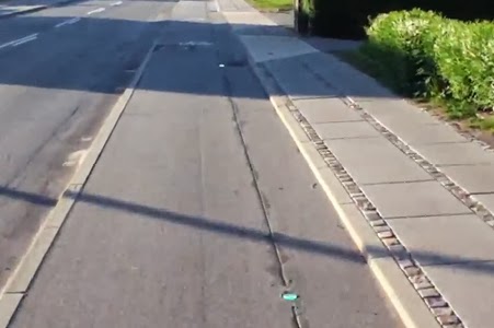
(10/23/2013 | Lane Lights on Hadsundvej | Credit: Cat Silva)
According to the 2011 evaluation, 73% of respondents were aware of this initiative. The remaining survey results may indicate that the average users may not understand them or value their importance. 34% of respondents said that they thought they were important, 34% also said they were not important, and the remaining 32% did not provide a response. As is discussed in the evaluation, this split may be due to the fact that the survey was given soon after the initiatives were implemented.

This initiative is intended to test the functionality of this technology to provide free flow conditions for cyclists. That there was such a split in the importance of the lights, it is indicated that they are only able to positively influence the flow of bicycle traffic if users actively understand the technology.

(6) Route 100 Signposting

Along the route from the City Centre to the main campus of Aalborg University, signposts were installed stating the name of the route as “Route 100”, with “Universitetsruten” (the university route) underneath. None of the CIVITAS planning documents for measure 51 discuss which project goals these signs aim to meet. The most obvious interpretation of the provision of wayfinding and branded signage is to improve the visibility and services along the route. All road users along Route 100 are likely to see these signs and, over time, may begin to associate the route with “Route 100”.
(10/12/2013 | Official Route Sign for Route 100 | Credit: Franziska T.)
Just as there were no stated goals of this imitative, the wayfinding and Route 100 signage was not evaluated in 2011. As such, there is no present data on how effective or important Route 100 users find this initiative. Due to this lack of users feedback, little can be accurately determined about the effectiveness of this initiative.
(10/12/2013 | Directional Wayfinding Sign for Route 100 | Credit: Franziska T.)
The first signpost along the route in the City Centre is a directional sign indicating a right-hand turn toward Route 100, with 4.2 kilometers to reach the Aalborg University. The placement and height of this sign is a notable issue, concerning its usefulness and legibility. The sign is surrounding by foliage that hinders oncoming bicyclists from reading the sign. It is also located on the left hand side of the bicycle path that, arguably, is not the location most suitable for a right-hand turn—that is, riders must see it on their left-hand side shortly before they must safely take a right turn.

(7) Reverse Duty Right of Way at Bonnesensgade & Fyensgade

At the intersection of Bonnesensgade and Fyensgade, directional priority has transferred to traffic moving along Bonnensgade, as opposed to Fyensgade. This intersection change was not included in the “tool box” of initiatives described in the CIVITAS documentation of measure 51, but it was investigated in the evaluation of the route. To that end, there is no found documentation of the intention behind this change. As the priority has changed at that intersection to decrease wait time for those traveling in both directions along the path of Route 100, it can be extrapolated that this initiative is intended to create free flow conditions for bicyclists and may also have been intended to increase traffic safety.

According to the 2011 evaluation, 46% of respondents were aware of this initiative and 29% feel that this intersection improvement is important. Most survey respondents stated that they “Don’t Know”, and the evaluation states that bicyclists reported feeling “insecure, uncomfortable and unaware” and that “accidents seem unavoidable”. Although most were unsure if this was important and expressed discomfort, the overall commute trip time for bicyclists has reduced by an average of 12 seconds along the Route 100 corridor after the spring of 2011. This is reduction amounts to approximately 26% shorter stop times heading in both directions.
(10/12/2013 | Reverse Duty Right of Way at Bonnesensgade & Fyensgade | Credit: Franziska T.)
The evaluation describes the bicycle filter lane and this improved intersection to be the most impactful on this decrease in travel time. The filter lane only provides free flow for bicyclists heading to Aalborg University campus, yet that this reeducation is relatively equal in both direction implies that the reversed duty to give way at Fyensgade may have a strong influence on travel speed. That most respondents were unsure if the intersection was making any difference could be due to the fact that this total change does not feel like very much.  Moreover, as with initiatives like the lane lights, may not have been fully appreciated by riders as the survey was given shortly after the infrastructure was implemented.

As a part of evaluating the Route 100 project, as a whole, accidents reported along the route were mapped out for the from 2005 to 2009 and again from 2011 to the first half of 2012. During the first period, bicycles or mopeds driving in the bicycle lane were involved in 27 of 55 traffic accidents along the Route 100 alignment. It is then stated that, during the latter period, less than half of the yearly average of traffic accidents were reported—although no figures are provided in the evaluation report.

None of the reported traffic accidents looked at in the evaluation after 2011 occurred at this intersection, yet the comments from the survey indicate a concern among bicyclists. Part of this concern could be partly psychological. There may be a lack of trust that traffic moving along Fyensgade—the perpendicular street—will actually yield to traffic and bicycles traveling along Bonnesensgade.  Getting used to having priority and becoming more confident when crossing this intersection may be a process that could adjust how important this change is to bicyclists and other road users over time.

Check Back Soon! 

Over the next week, I will be looking closely at the results of my research project's evaluation and relating our results back to the 2011 evaluation…. 

Friday, December 13, 2013

Bring Your Own...

Earlier this week, I joined others involved with the Mobilities Design Group at C-MUS for an afternoon seminar. The title of this event was "Bring Your Own…Models, Plans or Objects of Mobilities Design". There was no exact prescription for what participants should bring and no rule that the work had to be your own. The primary purpose was to share our own thoughts and experiences as well as engage in a dialog about what Mobilities Design means and what it is.


Asking..."What is this thing?"

My research partner and myself used this as an opportunity to exhibit our current research, present preliminary results of our user survey, and start thinking about how to pull it all back into mobilities design. Although our project is comprised of four research questions, we targeted in on our largest and most complex question: "Route 100 - What is this thing?" This question was a uniquely appropriate focus for this seminar, as it is essentially asking "What mobilities is this space designed for?…Why?…How?…When?…For Whom?…Under what circumstances?…For what purpose?" That is to say that this primary focus of our work begs us to consider what it is that Route 100 is, with respect to its physical infrastructure of the space, the planning that went into it, the goals it aims to achieve, and how it is experienced by users.

Of all the presentations, we were the only individuals presenting an active Mobilities Design research project. This meant that our part of the conversation was more in the realm of "how do we research mobilities design" instead of "how is this mobilities design." Joining the seminar from this perspective, we described the theoretical framework that we are using and linked our analysis of the survey results and user interviews to this methodological approach. The framework that we are working with is the Staging Mobilities Model that is a structure developed by our supervising Professor Ole B. Jensen at Aalborg University in his book likewise titled Staging Mobilities.

The perspective taken in this book established "a shorthand for a way of thinking about the relationship between mobilities and cities..." Jensen proposed a model for considering mobilities is comprised of three primary pieces: 1) Physical Infrastructure--the materials, facilities, physical and technological services, etc; 2) Embodied Performers - the people interacting with the facility, the users, the bicycle riders, pedestrians, drivers, etc; and 3) Social Interactions - the way people interact with one another as they interact with the infrastructure. This framework then addresses that how these three pieces come together depends on the policies, regulations, and political will "from above" and how those coming into contact with the infrastructure are using the space "from below". As researchers, we are sitting int he middle of the model, looking out, trying to ascertain what the space really is--what mobilities are actually afforded or hindered as a result of the infrastructure.
(11/09/2013 | Staging Mobilities Model | Credit: Ole B. Jensen)
Considering our question asking what Route 100 is, we are adding to the "from above" and "from below" portion of this framework as we consider how and what we should be focusing our research on. Our current thinking is that the "from above" concept primarily interacts with the Physical Infrastructure and the "from below" portion is mainly involved with the uses by Embodied Performers and the Social Interaction among users. While we recognize that there absolutely is cross over, this is our starting place for our investigation of the route. We tentatively have four primary areas we are looking into to better understand the "from above" of Route 100, which are: 1) Physical Limitations; 2) Design Guidelines; 3) Municipal Policies; and 4) Project Financing. We anticipate that there are many more areas that will play into this and expect to expand what is under the "from above" umbrella.
(12/10/2013 | Route 100 Working Theoretical Framework | Credit: Cat Silva)
With regards to how we are looking at Route 100 "from below", we have planned that our online user survey and interviews with users will help us frame how to best investigate how the route is affected by those interacting with it. Our online survey closes tonight and our last interview will take place on Wednesday, December 18th. So far we have received feedback from 171 survey respondents and we will have completed 8 or 9 interviews with users. Based on our analysis of the results and what we learn from our nine interviews, the "from below" portion of our expanded Staging Mobilities model will become more refined as we develop categories for how to explore and discuss users and their interactions.

The Seminar

The presentation we gave at this event can be viewed below. (You can scroll through it within this post or click on the presentation for a larger version.) If you are interested in a downloadable copy, please contact me with you inquiry.


This was the first such event for the Mobilities Design Group and I thoroughly enjoyed the experience. Our own presentation led into a great discussion about how bicycle infrastructure and facilities are implemented and how different road users interact with them. My favorite comment came from a research assistant expressing the often accurate fact that bicycle lanes in the United States are unable to provide the same level of safety as infrastructure typically provided in Denmark - pointing to the grade-separated facilities often seen on major roads here. To this, I responded that I 100% agree, but there are bicycle lanes on routes like Route 100 and these lanes seem more capable of providing security for riders than what we have in the States. My reasoning is that in a Danish context, all types of road users take better care of one another. The man driving the car, and the woman walking across a bicycle lane, understand the experience of the student riding their bicycle. In a country where riding a bicycle is such a germane task, you end up with drivers that yield better to pavement markings indicating bicycle priority. Back home, drivers often look at bicyclists as "in the way" and bicycle lanes are disrespected and are often blocked by unloading trucks or cars dropping off passengers. In this line of thinking, we had a great discussion of how the bicycle lane is has the chance to take on a different character in a Danish city. Here, there is a greater deal of respect and understanding given to bicyclists by other road users, which influences how effective a single painted lane and bicycle pavement marking can be for providing safety. Of course they're not perfect in any context...but it was a great discussion!

Topics that others brought to the table in the seminar included:

  • A model of new Nørrebro Station area in Copenhagen, which was created by students attempting to design a site plan accommodating intermodal use of the space. The concept was based on a telephone operator's switchboard, and focused on how different users have different needs, uses, and time constraints as they pass through the station area.
  • Images and a video of the Highline in New York, presented as an example of designing for non+motorized mobilities and experiences in an interesting way. He pointed out that the park is experienced differently than the large expansive parks often provided, due its linear shape and connection it has to so many different parts of the city.
  • The introduction of a sleeping pod provided in the international airport in Delhi, which provides travelers a quite space to nap and relax in between place to place. The room can be rented for $10/hour and comes with a chair, bed, and sink...providing comfortable, private space in an often uncomfortable, public area.
  • One individual even presented her self as an example of designed mobilities, discussing how mobilities have designed who she is and how she perceives and interacts with the world. She suggested that you don't really think about "home" is until you leave it and addressed the cultural, financial and infrastructural influences on how mobile each individual person is designed to be.
  • And, photos from a presentation given by urban design researchers to a class of planning students. They introduced diagraming to the students and asked the planners, who normally focus on the written word, to grab a pen and diagram a project, concept, or idea they have been working with. This was easily my favorite - it was great to see the outcome and interdisciplinary interaction!


Wednesday, November 20, 2013

Mobility on the Faroe Islands

This past week I took a trip to the Faroe Islands with my boyfriend to explore the group of islands under the sovereignty of the Kingdom of Denmark. Although November is not necessarily the best time to visit the islands, it was a week long adventure full of beautiful views, odd encounters, and insane weather.

Although thereis much that I could share…it seems fitting to recount the various forms of transportation that we experiences in passing or in person during this trip… We made it to 8 of the 18 islands, so we did see quite a bit…but I should note that we very likely missed bits and pieces, but this post shows what I did see and experience during the week-long visit.

By Aircraft

Atlantic Airways provides the majority of connections to Vágar Airport on the Faroe Islands. A traveler can fly to this destination from Norway, Iceland, England, Spain, or one of three airports in Denmark. This time of year, we got the best price by flying out of Copenhagen and arrived in the North Atlantic Ocean less than two-hours after we took off.
(11/09/2013 | Atlantic Airways Plane at Vágar Airport | Credit: Cat Silva)
When we landed the flew so incredibly close to the ground that it was somewhat nerve-wracking…but the decent is beautiful as you suddenly see a group of islands out in the vast ocean.
(11/08/2013 | Atlantic Airways landing in Vágar Airport | Credit: Cat Silva)
Something very interesting we learned after we arrived is that helicopters are considered a part of the normal transportation system. Privately operated by Atlantic Airways, helicopter transportation is available between 10 destinations across the 18 islands. A ticket is around $35 per person, making the trip quite reasonable. Seats are prioritized for locals - as there are some who rely on the mode to get to their remote homes and have groceries delivered - but tourists are able to book a seat and have the chance to see the islands from above. An interesting thing is that you can only take a helicopter one-way on a given day. This means that you need to plan for a place to stay - which is difficult to impossible in some places - and/or you need to plan for a ferry back to home-base that day or the following day.

There are flights on the helicopter every Sunday, Monday, Wednesday, and Friday - however during this time of year Monday flights are not in operation. Trying to take advantage of this quick and exciting form of transportation, we had booked a helicopter on from Torshavn to Klacksvik on a Wednesday afternoon. Unfortunately, the weather was not favorable and  the flight was cancelled, causing us to loose our chance to experience this unique aspect of the visiting the Faroe Islands. Although I have no photos of this non-occuring-experience to post, I will share a video I found on YouTube that captures what we may have experienced.

(09/24/2009 | Faroe Islands Helicopter | Credit: Kovboyfilm via YouTube)

By Bus

One very neat thing about visiting the Faroe Islands was how seeing how well different modes of transportation are coordinated. After every arrival at Vágar Airport, bus number 300 leaves from the airport, transporting arriving passengers to Tórshavn, largest town and the capital of the Faroe Islands. The bus literally waits until passengers have picked up their bags and the airport gives an announcement letting passengers know when the bus is soon departing. You can purchase a one-way ticket for this hour long journey for $16, but we opted to purchase 7-day passes for $127. These passes allow for unlimited use of all buses and ferries operated by Strandfaraskip - the national public transportation company.

The bus system was impressive, in that it connects nearly every corner of every island, with 20 different bus lines operating throughout the country. On top of that, in Tórshavn there are 5 bus routes that operate from around 6am to 11pm on weekdays and are always free to use. While this local system appeared pretty reliable, all of the national bus lines do not run all that often. The bus to and from the airport runs pretty regularly, but on some islands there are only 2 or 3 trips daily. As a resident, this likely works fine. But as a tourist, this means careful trip planning is necessary, as a great many towns and villages do not provide any where for you to stay over night should you miss the last bus.
(11/09/2013 | Bus Stop Pavement Marking | Credit: Cat Silva)
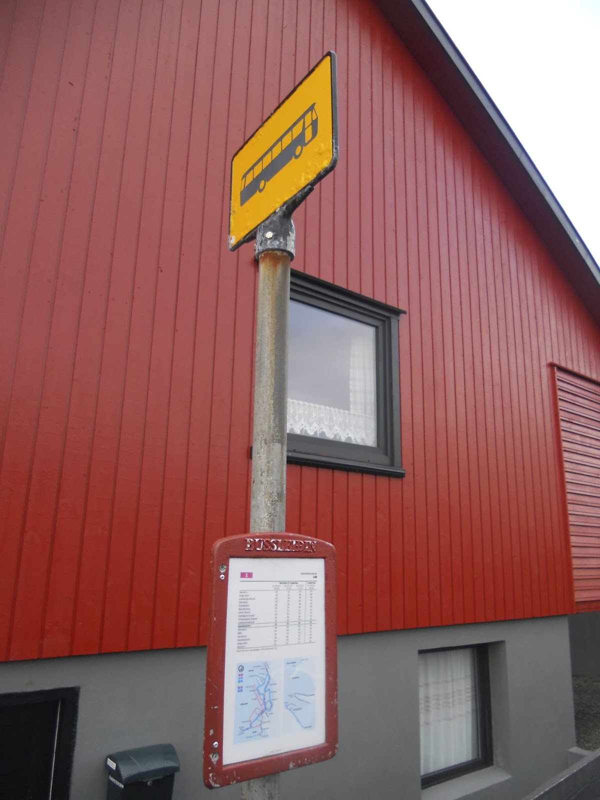
I really liked the bus stops we saw in Tórshavn. At stops where there was enough space in the roadway for a short-term lay-over space for buses, there was a great pavement marking on the street. The bold, bright white marking is a clear sign that it is a space for busses, not cars. At these more significant stops, there was usually a bus shelter provided for waiting passengers.Where there was not a shelter provided, a pole with a sign signals where the stop is. The stops for the free buses in Tórshavn were indicated by a yellow sign with a bus icon. These stops always displayed a time schedule posted and the bus numbers are posted on the time schedule.
(11/09/2013 | Local Bus Stop Pole in Tórshavn | Credit: Cat Silva)
It was a little different for the national buses operated by Strandfaraskip. The sign for these routes were blue throughout the islands - which is the same as what you see in some places around Denmark. At some stops, there were shelters and at others there were only bus stop poles. From those stops I saw, there were no bus numbers or time schedules posted. In some ways, it is shocking that there is so little provided at some stops. But, the locals, the regular users, understand the system and know how to navigate it. And as for tourists, it's a little confusing, but it worked really well for us. The drivers knew we were tourists and an overt effort on their part was made to make sure we made to and from our destinations. 
(11/11/2013 | Regional Bus Stop Pole in Tvøroyri | Credit: Cat Silva)

By Boat

As this is a place comprised of islands, it may come as no surprise that there are seven different ferry lines connecting the coastal towns and villages. On our second day, we took the ferry that leaves from Tórshavn to Nólsoy, the small island 4 km across the harbor. Although this ferry, called the M/F Ternan, can hold up to 95 passengers and 32 vehicles, there were only only 10 passengers and maybe 2 cars.
(11/10/2013 | Strandfaraskip M/F Ternan from Tórshavn to Nólsoy | Credit: Cat Silva)
After a short 25-minutes sailing, we docked in the small village of Nólsoy. From there we took a hike to Borðan, a lighthouse on the south end of the island from the 18th-century. Supposedly, the lighthouse keeper who lives in Nólsoy walks out there every day…but we saw tire tracks and are pretty sure that the tourist office may not have been entirely accurate. Today, the lighthouse can be seen on commemorative coin worth 20 Danish Kroner issued by the Bank of Denmark in 2005.
(11/10/2013 | Borðan Lighthouse on Nólsoy | Credit: Cat Silva)
Then, on our third day we decided to hop on the early morning connection to from Tórshavn down to Suðuroy, the island furthest to the south. This ferry is the largest that operates in the Faroe Islands and is named M/F Smyril. Far larger than the first ferry we boarded, this boat holds up to 975 passengers and 200 cars. Before this ferry was built in 2005, there was no boat connection to Suðuroy and the 2 hour trip opened up opportunities for locals to commute to Tórshavn for work and play, as well as provided much easier access for tourists like myself. It takes nearly 2-hours and, out on the North Atlantic Ocean, this was one of the roughest ferries and most windy decks I have ever been on.
(11/11/2013 | Strandfaraskip M/F Ternan from Tórshavn to Tvøroyri | Credit: Cat Silva)
On a monday, the ferry does three trips back and forth from Tvøroyri to Tórshavn. Our plan was to make this a day trip…but as soon as we docked on Suðuroy, an incredibly nice woman on the ferry explained to me that the last ferry out was cancelled due to bad weather in Tórshavn. This meant, unless we stayed on the boat and went directly back, we would be stranded until the first ferry the following morning. We weren't about to loose the opportunity to see Suðuroy, so we hopped off the boat and settled into being stuck for the night.

It was that day that we learned why the Faroe Islands is know as the "land of maybe"…maybe the weather will cancel the ferry…maybe I'll get home tonight… And you know what, learning that was easily the best and most interesting part of our trip.

By Bicycle

I looked high and low the entire time we were on the island…but it turns out that bicycling is not a common mode of transportation used on these islands that tend to be extremely windy, prone to sudden rain storms, and are hill-filled and car dominated. Bicycle lanes were no where to be seen on roadways and the one time I thought I saw a bicycle rack, it turned out just to be a small gate. That said, I did uncover some evidence that a few lonely soles are out on their bicycles!

On the street parallel to SMS, the shopping mall in Tórshavn, there was a shared-use path for bicycles and pedestrians. We didn't see any bicyclist using it that day, but it was the first and only piece of true bicycle infrastructure that I saw during the entire trip.
(11/09/2013 | Faced Bicycle Lane Marking | Credit: Cat Silva)
Where this path ends, there is one very faded bicycle pavement marking...
(11/09/2013 | Faced Bicycle Pavement Marking | Credit: Cat Silva)
And as we walked back to the village of Nólsoy, I saw couple of child playing on their bicycles. One nice thing about small village on a small island is that it's save to leave the bicycles unlocked and parked in the middle of the street…
(11/10/2013 | Children's Bicycles Parked in Nólsoy | Credit: Cat Silva)

By Car

Getting around by car is easily the most common form of transportation on the Faroe Islands. The country is well connected roads winding around the islands, providing access from the largest towns to the smallest villages. The infrastructure is a little complicated, but the biggest danger are the sheep that freely wander around all the islands grazing on the grass and slowing down traffic when they try to cross the roads.

(11/08/2013 | Windy Road on Vágar | Credit: Cat Silva)
With the exception of three incredible small islands with few inhabitants, all the islands are either connected to their adjacent neighbor via a ferry or roads. Only two islands Streymoy and Esturoy are connected with an over-water bridge. And in the north, the island of Borðoy is connented to Kunoy and Viðoy with land bridges. Where the distance between islands is not short enough, the population has invested in subsea tunnels. 

And then there are the tunnels. Beginning in 1963, the Faroese have invested in tunnels through mountains on 7 islands. The first one built is 0.9 miles long and is located on Suðuroy. I'm fairly certain this is the tunnel we drove through this tunnel on a bus ride from Tvøroyri to Sumba. Today, the mountain tunnel is just over 2 miles long. Many are two-way, but not all of them. On the northern islands the tunnels have one lane, with priority given to one direction. Drivers traveling in the direction without priority must yield to oncoming vehicles by pulling into turn-outs that were located every eight of a mile - I think. There was good signage showing where the turn-outs were, and all the drivers seemed to navigate the system well, but it kind of felt like playing chicken. I was grateful that we only experienced these one-way tunnels as passengers, not drivers!

The first subsea tunnel connects Vágar to Streymoy. It is 3 miles long and was built in 2002 and connects Vágar to Streymoy. Then, in 2006, a second tunnel was built between Borðoy and Esturoy 
and is an impressive 3.8 miles long! One very cool thing about the newer tunnel is that, about half way through, there is aolorful light show designed by artist Tróndur Patursson, making the long ride more interesting for drivers and passengers. We heard that there is talk of building more tunnels, but they have been an expensive investment…so Maybe there will be more tunnels…or Maybe not...

I wish I had photos to share…but it was hard to take a photo of a dark tunnel from a moving vehicle…

By Foot

For a scarcely populated string of islands, the Faroe Islands was not always the most comfortable place to be a pedestrian. In Tórshavn, we felt like targets nearly every time we tried to cross a street. Even walking in the pedestrian core, it was necessary to watch out for drivers who were visibly irritated that you are in the way. We thought we were going to encounter quite town life, but instead there was a hurried, big-city feeling, only without any real traffic. We stayed at a hostel about a 20-minute walk uphill from the town and I was happy to see pedestrian wayfinding point us to a short-cut up. The only problem with this wayfinding is that once we made it up the first leg, there wasn't a second sign pointing to the unlit trail through stand of trees. It took us about 5-minutes to decide if it was the right way to go or not, and although it was, it was a little silly that they didn't add a second wayfinding sign to keep visitors on the right path.
(11/09/2013 | Wayfinding to our Hostel | Credit: Cat Silva)
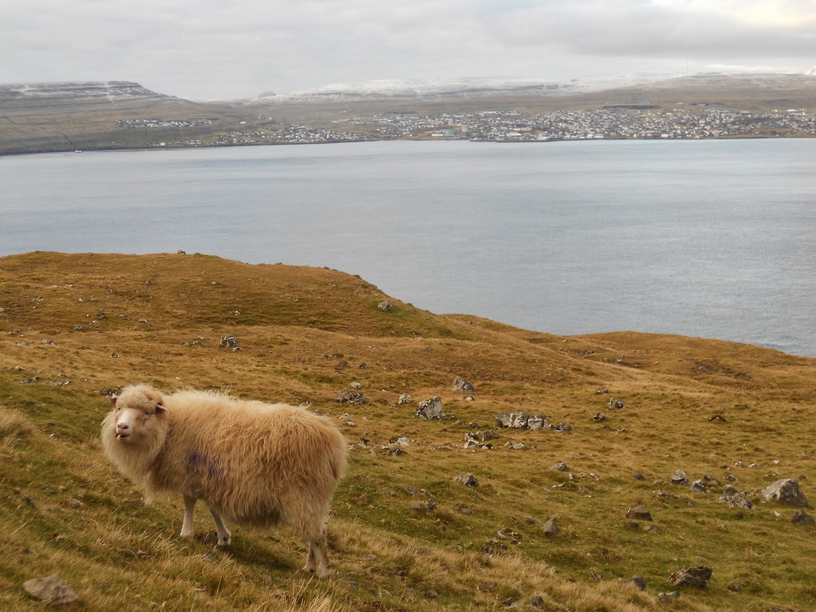
But there is one place where the pedestrian finds home is out on the hills, away from the towns and villages…and some of the  you can only see up in the fields with the sheep.
(11/10/2013 | Sheep on Nólsoy with Tórshavn in the Background | Photo Credit: Cat Silva)
A survey of 111 island communities given in 2007 by National Geographic  determined that the Faroe Islands is the best, as it is "authentic, unspoiled, and likely to remain so." I will note that it is difficult to spoil nature when there is a small population and the soil is infertile…but nonetheless, there is some truth in the survey results.
(11/10/2013 | Hiking on Nólsoy | Credit: Cat Silva)
The hiking does offer some peaceful reprieve from the chaos of the roadways! There are some hikes on the northern islands that could be pretty treacherous, but many are exceedingly simple and approachable. The hike we did on Nólsoy, for example. was mostly flat, with only a few small hills to climb. There are carins guiding The hardest part about the hike was making it through the wet lowlands that used to be harvested for peat and traversing across the small streams of water. And the best part was spending a day following sheep on the hills, miles away from anyone else, with beautiful views of the North Atlantic Ocean in the background. 
(11/10/2013 | Wayfinding on Nólsoy | Credit: Cat Silva)
If I ever make it back to the Faroe Islands…Maybe I'll do more hiking and see more of the quite corners of the islands…or Maybe it will rain the whole time...

Thursday, November 7, 2013

A Survey for Route 100 Users


To improve our analysis of the bicycle commute Route 100 in Aalborg, Denmark...my research partner and myself have created an online survey to learn more about the user experiences of the route.

The post below is a copy of what we have posted on the new blog for our research project. You can, of course, go directly to our blog by going to: Route100Reserachers.blogspot.dk

If you are someone who has any kind of experience with or knowledge of Route 100...please see the link at the bottom of this post and respond to our survey.

If not...you may simply read on and take a look at this pice of our research methodology.

.....

Have you heard of Route 100 in Aalborg, Denmark?

Are you a regular rider of Route 100?

Do you ride Route 100 occasionally?

Have you taken one or two rides on Route 100?

Do you plan to ride Route 100 in the future?

Have you used Route 100 in the past?

________________________________
 

If you answered yes to any of those questions, we would like to hear from you!

The following survey is looking for your thoughts, opinions, and feelings about Route 100. Seeking insight into rider experiences and and how the route is used, we would like to hear from locals and tourists, brand new and long time users, people young and old. Even if you haven't used Route 100 yet and may use it in the future, we would be glad to hear your thoughts!


The survey takes only 10-minutes to complete and is available online until Friday, December 13, 2013.

Read on to learn more about the the survey and/or look for a link to take the survey at the bottom of this post...

About Route 100

Route 100, also called "Universitetsruten", is Aalborg Kommune's dedicated bicycle commuter route connecting the City Centre to the main campus of Aalborg University. From August 2010 to June 2011, a series of upgrades to this route to improve rider safety, provide rider services, and improve the efficiency of getting from one end to the other.

Leaving from the City Centre, the route travels east along Østerbro from Nytorv, then heads south down Bonnesensgade, then along Samsøgade, Riishøjvej, and then onto Hadsundvej. After crossing over the Nordjyske Motorvej, the route turns onto Niels Bohrstien before arriving at Aalborg University. The total end to end is distance is around 5.5 kilometers.


Route 100: A Bicycle Commuter Route | Aalborg, Denmark | Map Credit: Cat Silva

The Survey's Purpose

This survey was written and is being used by a guest research team working at the Centre for Mobilities and Urban Studies, housed in the Department of Architecture, Design, and Media Technology at Aalborg University. This research team is engaged in writing a working paper analyzing Route 100, which may eventually become a journal article. 

Two of the main questions the research team is trying to answer are:

          1) Route 100 - what is this thing?
          2) What does Route 100 allow? What does it prevent?

The purpose of this survey is to seek out information on how users of Route 100 experience their ride, what they like and dislike about the facilities, and gage how well the route meets user needs.


Responses to this survey are entirely anonymous. The information learned from the survey will be used for only for the purposes of the research team's analysis of Route 100.


Should you have any questions or comments, you may email the research team directly at: Route100Researchers@gmail.com


Post-Survey Interviews

We know that all your thoughts and feelings about Route 100 cannot be reflected entirely through your response to this survey. Therefore, at the end of the survey, you are invited to submit your name and email address if you are interested in providing us with a more in-depth interview. These interviews are an opportunity for the research team to get a better feeling of how users of Route 100 - which will help augment and add value to what is learned through this survey.

Please note, that if you provide your contact information to be interviewed, your responses will remain anonymous in the final analysis of the survey results.

The research team will contact individuals interested in being interviewed to schedule a convenient date and time to meet. Interviews will take place between late-November 2013 through the end of the year.


The Route 100 Survey

The survey takes only 10-minutes to complete and it is available online until midnight on Friday, December 13, 2013.

Thank you - we appreciate your participation! Check back after the winter holidays to see some highlights of the survey results.